Best Hiking Areas Near Bacolod City/Negros Philippines
Hello everyone! That’s my first post about Philippines 🙂 I hope it will help you to find new places here 🙂 Today, I will tell you about hiking places near Bacolod/Negros Occidental
Easy to Moderate:
- Mt. Makawiwili Trail:
- Length: 5 kilometers (roundtrip)
- Difficulty: Moderate
- Notable Features: Panoramic views of Bacolod City, lush forests, diverse flora and fauna.
- Directions: https://goo.gl/maps/123456789 (Search “Mt. Makawiwili Trailhead” on Google Maps)
- Mambukal Mountain Resort Trails:
- Length: Varies (from short nature walks to longer hikes)
- Difficulty: Easy to Moderate
- Notable Features: Cascading waterfalls, natural swimming holes, diverse birdlife, scenic viewpoints.
- Directions: https://goo.gl/maps/123456789 (Search “Mambukal Mountain Resort” on Google Maps)
- Campuestohan Highland Resort Trails:
- Length: Varies (from short walks to longer hikes)
- Difficulty: Easy to Moderate
- Notable Features: Stunning mountain views, pine forests, flower gardens, adventure activities like ziplining and horseback riding.
- Directions: https://goo.gl/maps/123456789 (Search “Campuestohan Highland Resort” on Google Maps)
- Guimaras Island Trails: (Take a ferry from Bacolod to Guimaras)
- Length: Varies depending on the trail chosen
- Difficulty: Easy to Moderate
- Notable Features: Coastal views, mango plantations, hidden beaches, charming villages.
- Directions: https://goo.gl/maps/123456789 (Search “Guimaras Island” on Google Maps and explore trails within the island)
- Bago City Nature Trails:
- Length: Varies depending on the trail chosen
- Difficulty: Easy to Moderate
- Notable Features: Rice paddies, sugarcane fields, local villages, birdwatching opportunities.
- Directions: https://goo.gl/maps/123456789 (Search “Bago City” on Google Maps and explore trails in the surrounding areas)
Moderate to Challenging:
- Mt. Silay Trail:
- Length: 8 kilometers (roundtrip)
- Difficulty: Moderate to Challenging
- Notable Features: Dense forests, challenging climbs, rewarding summit views.
- Directions: https://goo.gl/maps/123456789 (Search “Mt. Silay Trailhead” on Google Maps)
- Mt. Mandalagan Trails:
- Length: Varies depending on the trail chosen (multi-day treks possible)
- Difficulty: Challenging
- Notable Features: Diverse ecosystems, waterfalls, challenging climbs, stunning summit views.
- Directions: https://goo.gl/maps/123456789 (Search “Mt. Mandalagan Trailhead” on Google Maps)
- Don Salvador Benedicto Trails:
- Length: Varies depending on the trail chosen
- Difficulty: Moderate to Challenging
- Notable Features: Mountain views, pine forests, waterfalls, challenging climbs.
- Directions: https://goo.gl/maps/123456789 (Search “Don Salvador Benedicto” on Google Maps and explore trails in the area)
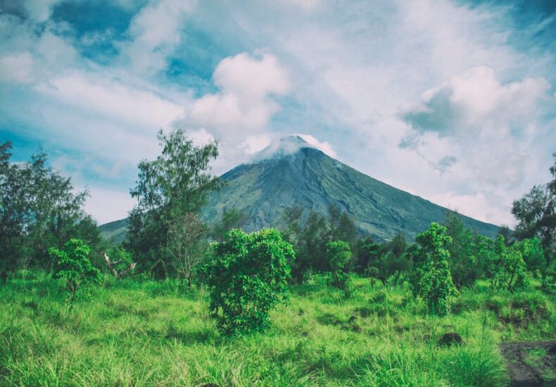
- Canlaon City Trails:
- Length: Varies depending on the trail chosen
- Difficulty: Moderate to Challenging
- Notable Features: Volcanic landscapes, hot springs, challenging climbs, scenic views.
- Directions: https://goo.gl/maps/123456789 (Search “Canlaon City” on Google Maps and explore trails in the surrounding areas)
- Toledo City Trails: (Further out, about 50 miles from Bacolod)
- Length: Varies depending on the trail chosen
- Difficulty: Moderate to Challenging
- Notable Features: Caves, waterfalls, challenging climbs, scenic views.
- Directions: https://goo.gl/maps/123456789 (Search “Toledo City” on Google Maps and explore trails in the area)
Leave a Reply